muddypup wrote:Boggy Man wrote:Muddypup:
Another place in central Alberta to consider is the upper part of the McLeod River west of Edson, later in the season when the water levels are low. The area there just screams quicksand!For example, here is a zoomed-in view of one prospective place at low water levels that, based on its appearance and on my experience, should be an absolute certainty for containing quicksand!
Look at where that small stream goes through that sand bank, and how that sand bank quickly drops off into deep water at that stream exit! A sure indication of an extremely deep deposit of loose sediment!

https://www.google.com/maps/@53.4904122 ... a=!3m1!1e3
thanks for the extra tip and exploring areas! will definitely be checking this one out later on in the season.
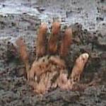
I should mention that those dark areas may be sand like the light areas, only wetter, or they might be clay.